Find Your Daily Voice
Tag: Severe Thunderstorms
Severe Thunderstorm, Tornado Watch In Effect For South Jersey
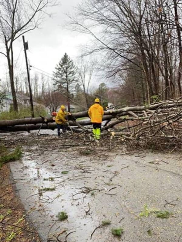
Strong to severe thunderstorms will move through the area Monday afternoon, Aug. 7 and Monday evening, according to the National Weather Service.
The storms will bring the potential for damaging wind gusts, a few tornadoes, and localized flash flooding, the NWS said.
The tornado watch includes Mercer, Atlantic, Burlington, Camden, Cape May, Cumberland, Gloucester and Salem counties, the NWS said.
A slighter chance of thunderstorms exists along the Jersey Shore.
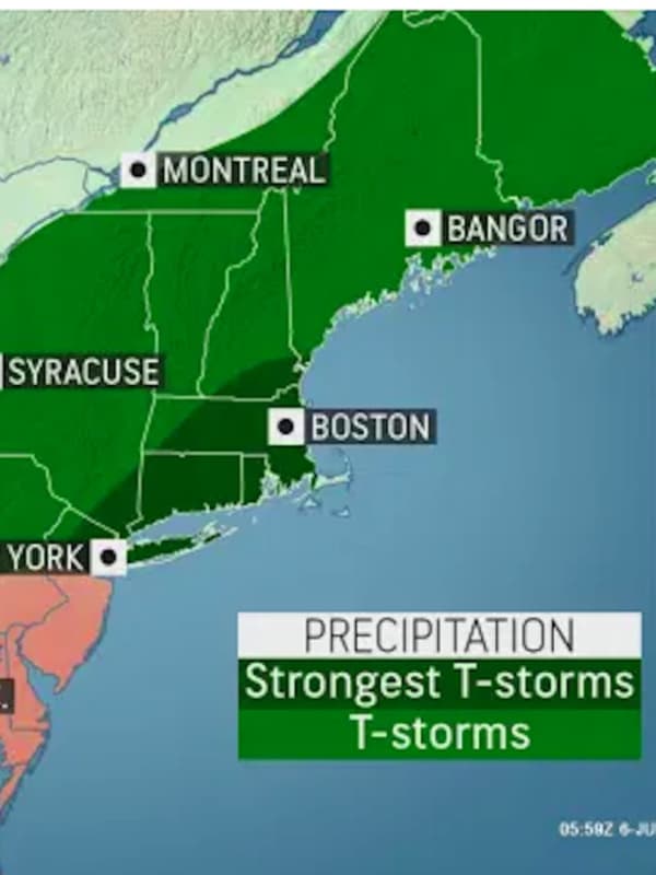
Brace For Isolated Twisters, Flash Flooding Across NJ, Forecasters Say
Up to three inches of rain, flash flooding and damaging winds were expected Thursday across New Jersey.
A flash flood watch was in effect for Bergen, Essex, Hudson, Hunterdon, Mercer, Middlesex, Morris, Passaic, Somerset, Sussex, Union and Warren counties Thursday morning into Friday.
Severe thunderstorms with potential for isolated twisters were also possible, the National Weather Service says.
The main threat was expected midday Thursday into the early overnight hours, the NWS says.
Storms were, however, expected to move out quickly Friday.
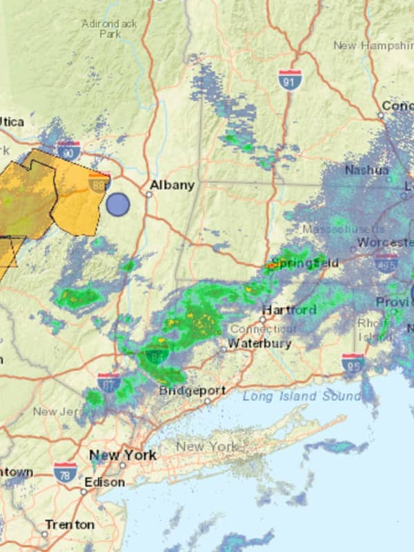
New Round Of Severe Storms Sweeping Through Region
For the third straight day, a line of severe thunderstorms is moving through the region from west to east.
Scattered storm activity is expected Thursday afternoon, July 8, and into the evening.
At 12:45 p.m., storms with heavy rain have arrived in New York, north of I-84 in Orange, Ulster, and Dutchess counties. Storm activity could become more widespread later.
Damaging winds gusts of around 60 miles per hour are the main threat, the National Weather Service said.
Related story: Here Comes Elsa: Tropical Storm Will Bring Heavy Rain, Gusty Winds To Region
In addition, localized heav…