WESTCHESTER COUNTY, N.Y. -- The potential for a quarter inch or more of ice accumulation in addition to the projected significant snowfall in the latest storm to hit Westchester should make walking and driving conditions hazardous through Monday evening.
A Winter Storm Warning issued by the National Weather Service is now in effect for Northern Westchester from 7 p.m. Sunday through 6 p.m. Monday. A Winter Storm Watch remains in effect for Southern Westchester through the same time period.
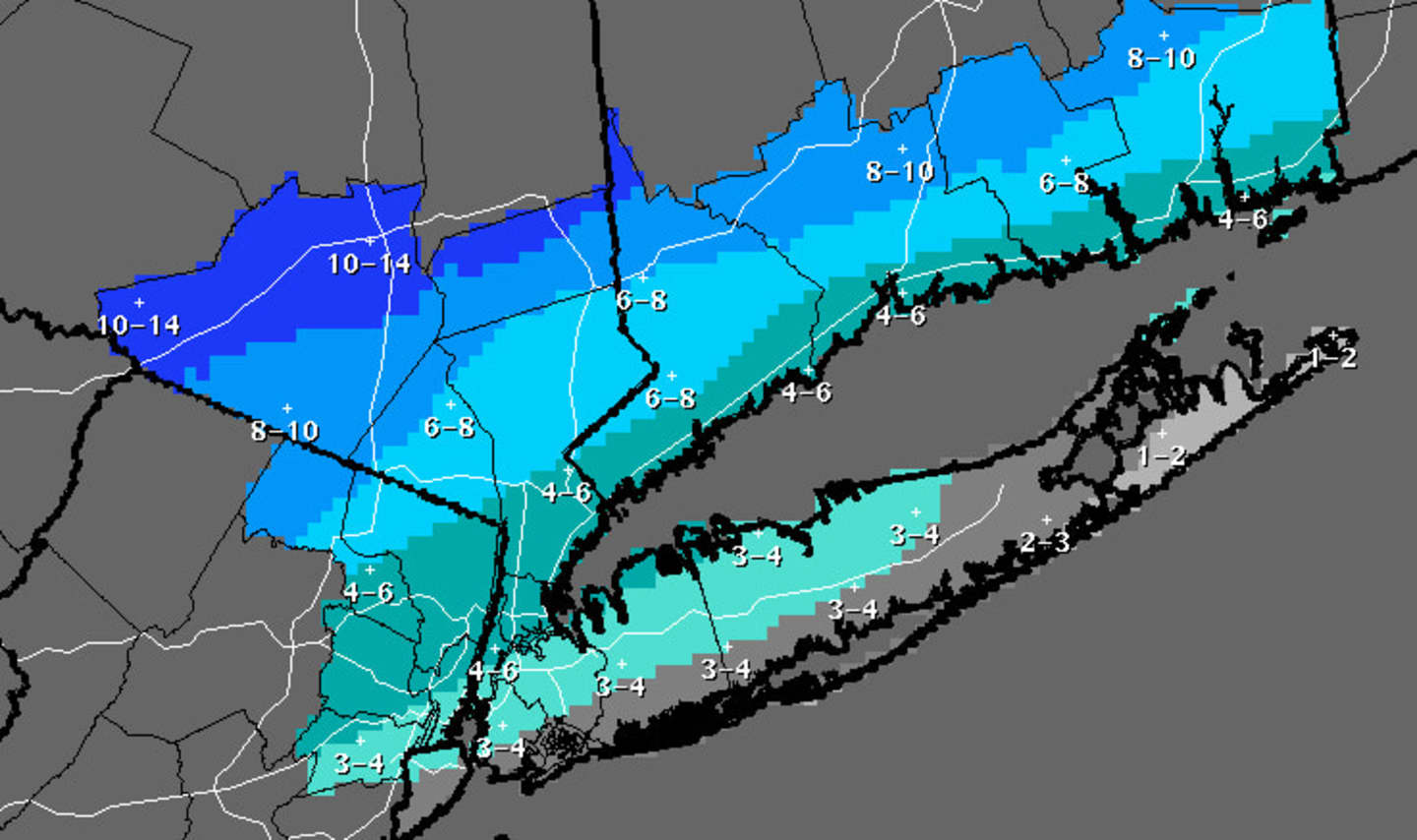
Snow that is expected to start overnight will mix with freezing rain and sleet during the day Monday, with adjusted snow accumulations of 4 to 6 inches of snow in Southern Westchester and 6 to 8 inches in the Northern Westchester, according to the National Weather Service.
Frigid temperatures will return later in the day Monday, falling into the teens by the late afternoon.
The outlook for Tuesday is mostly cloudy and cold with a high between 16 and 18.
Click here to follow Daily Voice Cortlandt and receive free news updates.