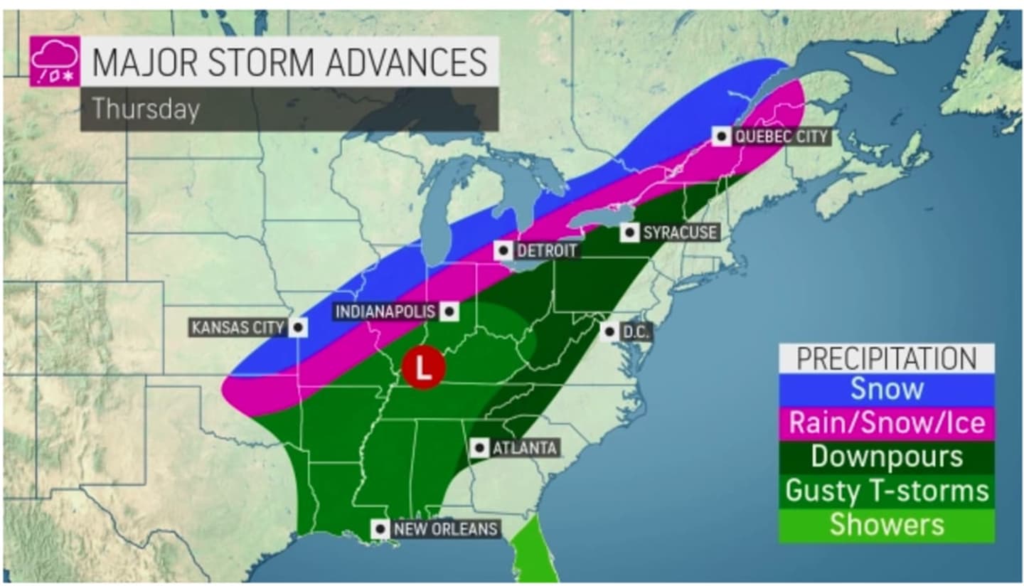

The strong cross-county storm moving from the west to east will arrive in the Northeast on Thursday, Feb. 17.
While this region is expected to be spared from snowfall, "damaging wind gusts in excess of 60 miles per hour" are possible late Thursday into early Friday, Feb. 18 "as a strong frontal system tracks through the area," the National Weather Service said in a Hazardous Weather Outlook statement issued Monday morning, Feb. 14 for southern Connecticut and southeast New York.
Power outages are possible during that time frame.
Areas farther north and inland are expected to see wind gusts of up to around 30 miles per hour.
The midweek system will dump as much as a half-foot of snowfall to parts of upstate New York and northern New England. (Click on the second image above for projected totals.)
Precipitation from the storm in this region will be in the form of showers due to a steady rise in temperatures during the week following a frigid start to the workweek on Valentine's Day, in which the high temperature will only be in the mid 20s, with wind-chill values in the single digits, with plenty of sunshines, according to the National Weather Service.
Tuesday, Feb. 15 will be another clear and cold day with a high temperature only in the upper 20s.
Temperatures will begin to rise on Wednesday, Feb. 16, which will be mostly sunny with the high in the low 40s.
The storm system is due to arrive early Thursday afternoon, when the high temperature is expected to climb into the mid 50s, with the potential for some spots in the area to record record highs, according to AccuWeather.com.
Showers and strong wind gusts will continue through Thursday evening into the early overnight hours on Friday.
Skies will clear around daybreak Friday, which will be mostly sunny with a high temperature in the mid to upper 40s.
Check back to Daily Voice for updates.
Click here to follow Daily Voice Cortlandt and receive free news updates.