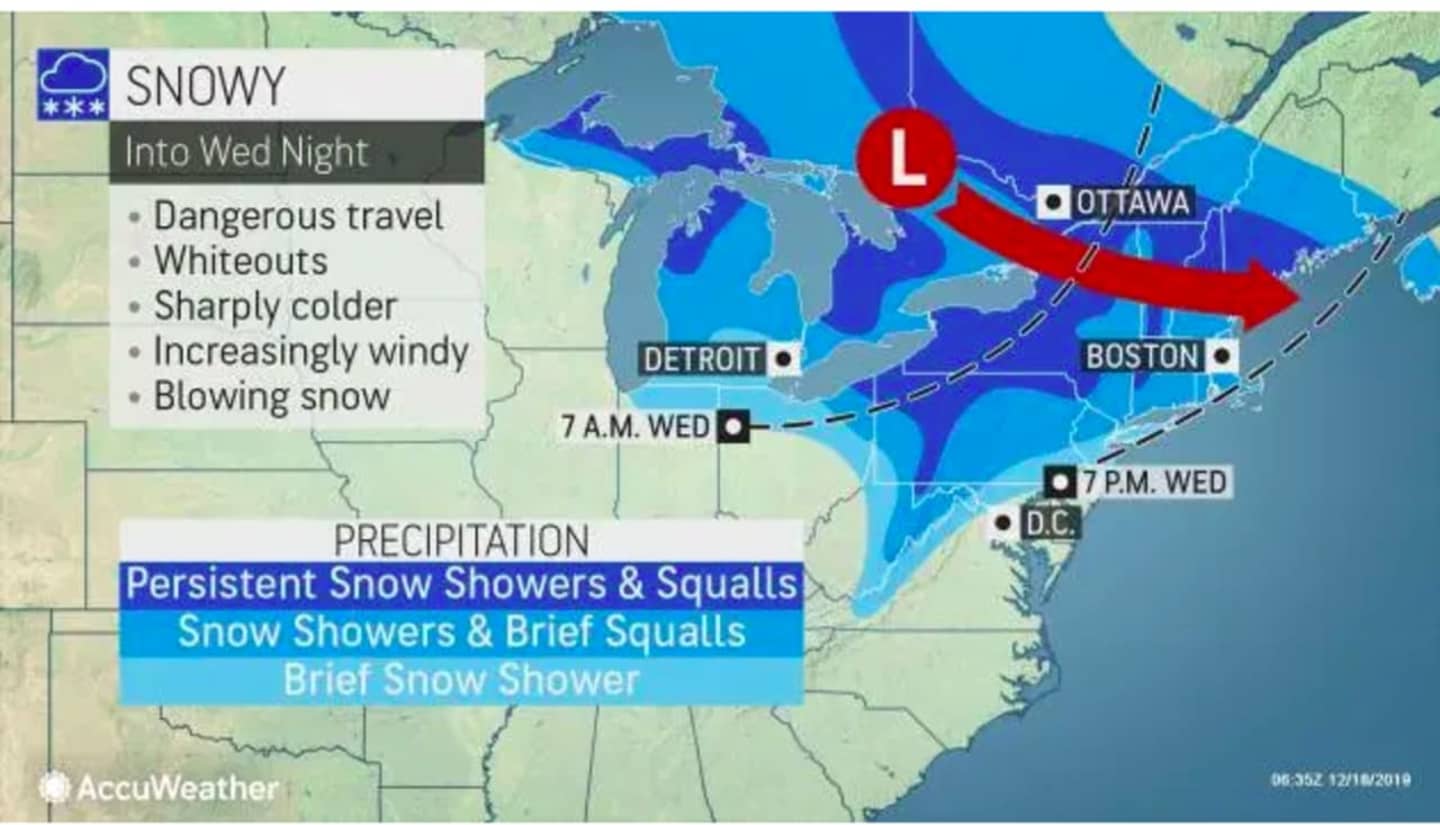
A few snow squalls are possible in the afternoon into the evening. The squalls could produce brief significant reductions in visibility, higher winds and a quick coating of snow, causing potentially hazardous travel conditions, the National Weather Service warned in a Hazardous Weather Statement issued Wednesday morning.
The high temperature will be in the mid 30s with wind out of the west between 10 and 16 miles per hour and wind-chill values between 20 and 25 degrees.
The chance for snow squalls and snow showers starts at around 3 p.m. and continues through around 9 p.m. Wednesday.
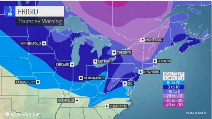
Thursday, Dec. 19 will be sunny and very cold, with a high temperature only in the mid to upper 20s. Winds between 13 and 17 mph with gusts between 20 and 30 miles per hour will make it feel like it's between zero and 10 degrees.
Friday, Dec. 20 will be another sunny day, but not as cold with the high temperature in the low 30s.
Check back to Daily Voice for updates.
Click here to follow Daily Voice Nassau and receive free news updates.